In this series, we regularly introduce native apps from Apple. In today's episode, we look at Maps - a service that Apple first introduced at WWDC in 2012 (until then, iPhones used Google Maps services). As you probably know, the beginnings of Apple's native Maps were slightly problematic, but the company gradually worked on improving this application and now the service no longer faces so much criticism. What does basic work with Maps for iOS look like?
It could be interest you

Navigation and sharing of estimated arrival times
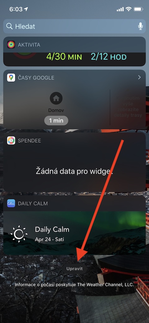
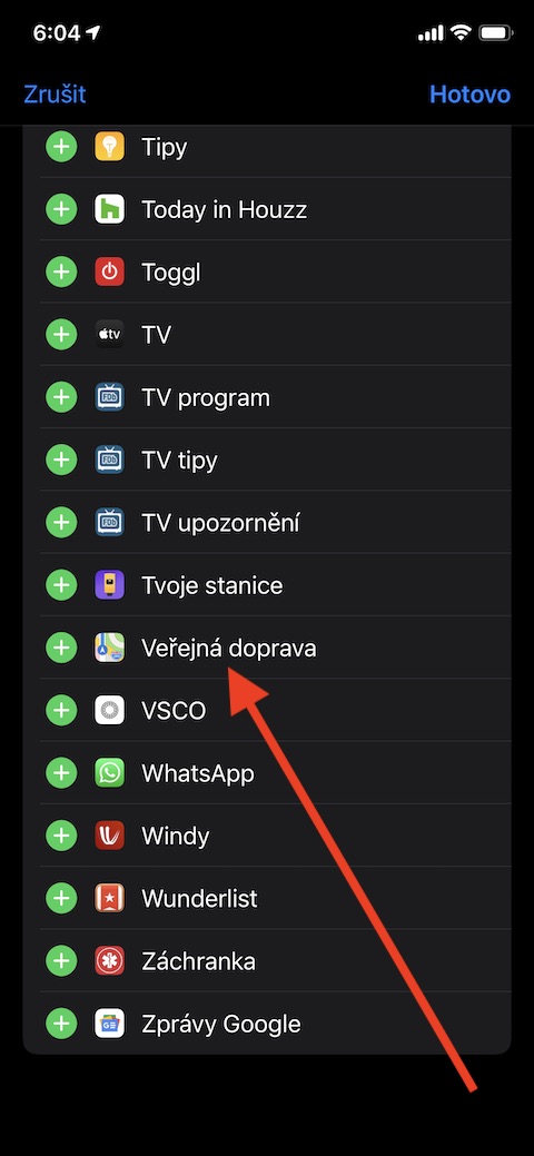
One of the main functions of native Maps in iOS is navigation. Method start navigation it's really very easy, but we'll describe it just to be sure. After launching the application simply enter the destination of the trip in the search field. On the bar at the bottom of the screen, then select how you need to get to your destination - by car, on foot, by public transport or by using transport services such as Uber. Depending on the traffic situation, the fastest possible route will be shown on the map - click the green button to start navigation Start to the right of the route suggestion. In the panel with the route you will also find information about the distance between the two places. If you want to find out the distance between the selected place and the location, which is not your location, tap the inscription before starting navigation My location in the menu and enter the desired location. If you plan route by public transport, you can set notification regarding changes, shutdowns or canceled connections. You can also use the lines you travel regularly Add to Favourites – just select the line you want to be informed about, swipe your finger up and tap on Add to…. If you want information about your favorite lines to appear on widgets page, return to homepage your iPhone by moving it transport go to the widgets page and move completely down. Click on edit, select the named widget in the list Public transport and tap on the + button add it to your widgets.
When traveling by car, you may want to - even at the cost of a longer or more difficult journey - avoid various highway and other charges. For notice of paid sections run Settings -> Maps, click on Steering and navigation a activate items Tolls a Expressway. When planning a route, you have a number of options in Apple Maps - one of them is adding more waypoints. In this case start navigation in the usual way and tap on gray stripe at the bottom of the screen to activate menu. Select here bodysuit, that you want in the route add (gas stations, breakfast, etc.) and tap on Start – it will be automatically included in your route detour. Changes in the route will of course be reflected in the estimated time of arrival. If you want this time to share with the person you just married, tap with navigation on gray stripe at the bottom of the screen, tap Share arrival and select the desired one contact.
Working with locations
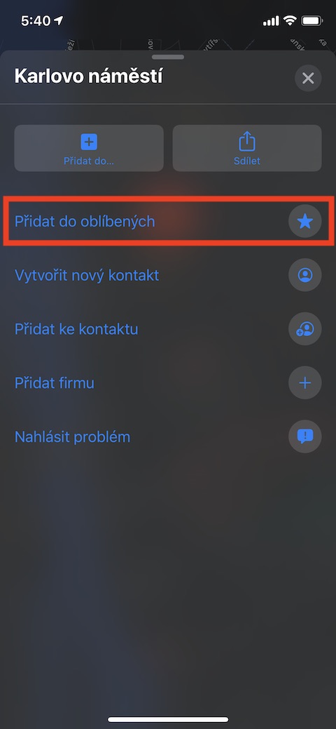
You can in native Apple Maps create a list of favorite places – work, school, or perhaps the addresses of relatives or friends – for faster access. Just select the place, pull out menu at the bottom of the screen and tap on Add k favorite. You must have also noticed the items in the menu New collection. Collections serve to sorting places into categories – you can create, for example, a collection of places you want to visit. For creating a collection find on the map place, that you want to add to the collection, invite menu at the bottom of the display and select Add to. Click on New collection and a collection name it. You can items in the collection (or entire collections) if necessary delete by sliding the panel with their name left.


