The application for maps is already in the basic iPhone menu. However, they have one major drawback – they are useless to you without a connection. It does not offer the option to save the cached maps, so you have to download the same data again every time you start again. That's why the OffMaps application was created, which allows us to download and save maps.
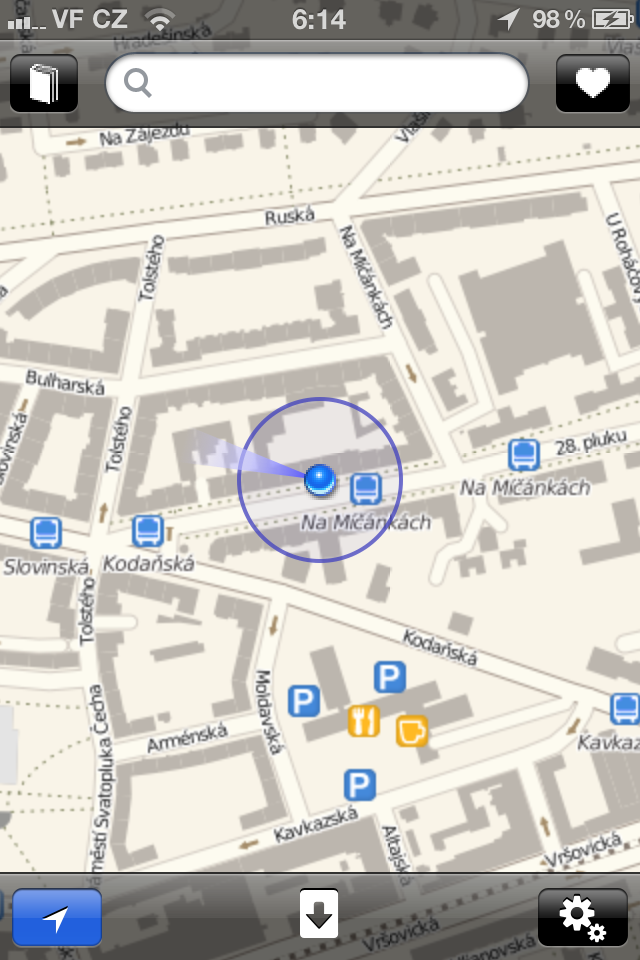
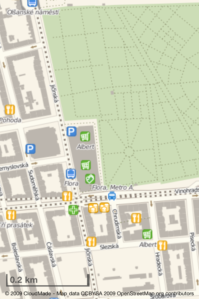
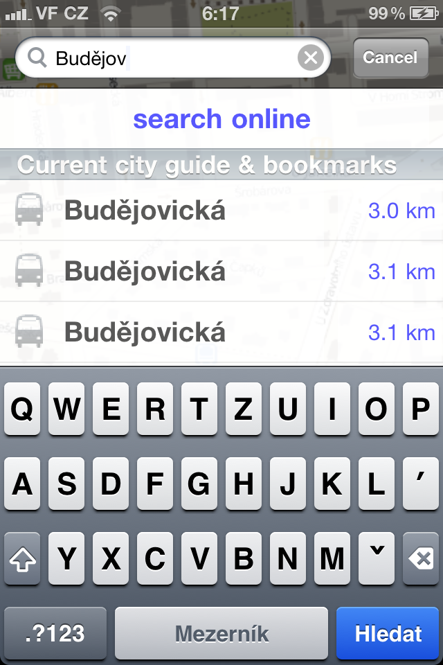
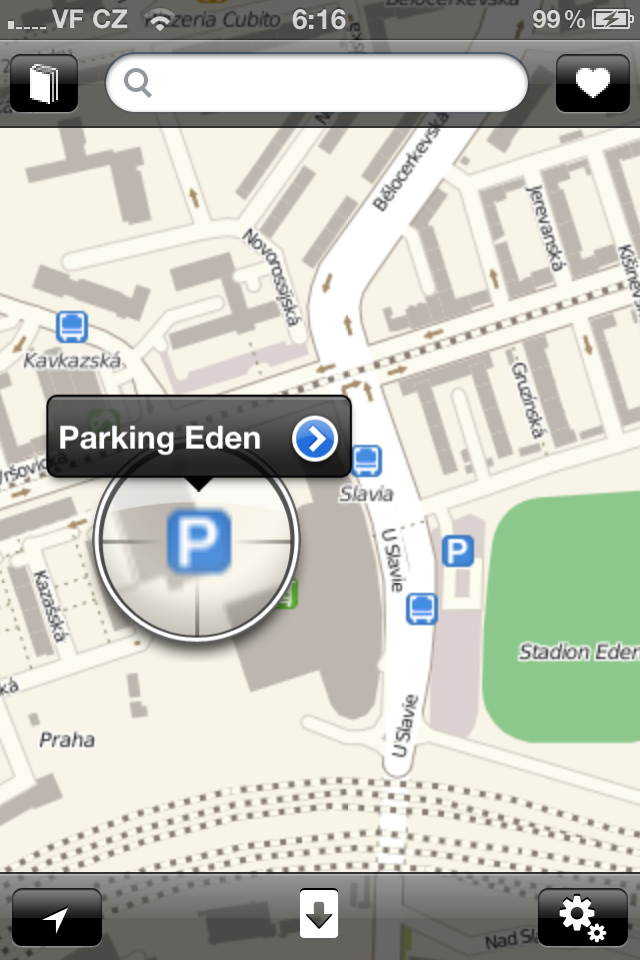
The application environment is very similar to the native one with Google Maps, search at the top, several buttons at the bottom and a large area for the map in between. It will get even bigger if you simply tap anywhere on the map, when all the elements will be hidden and you will be left with a fullscreen map with the scale at the bottom on the display. Of course, the same control as in Google Maps works here, i.e. scrolling with one finger and zooming with two fingers. When searching, the application then whispers streets and places to us (with a downloaded guide - see below), and users will also be pleased with the link to Wikipedia, where we can read something about the history of some POIs.
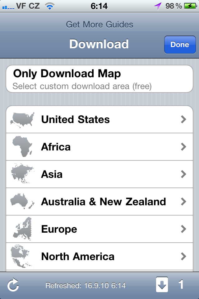
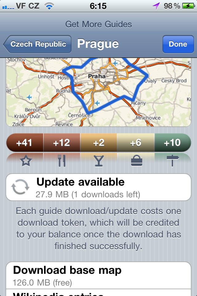
Of course, the most important are the map documents. In the case of OffMaps, it's not Google maps, but open-source OpenStreetMaps.org. Although they are a bit worse compared to Google, they do not have 100% coverage, so data for small towns or villages may be missing, but it is still a very high-quality base with many POIs, which is also still developing with the community. We can download the map section in two ways. Either conveniently via the list, which includes large cities from all over the world (10 cities from the Czech Republic and Slovakia), or manually. If you don't care much about phone space and your city is on the list, the first option will probably be more feasible for you.
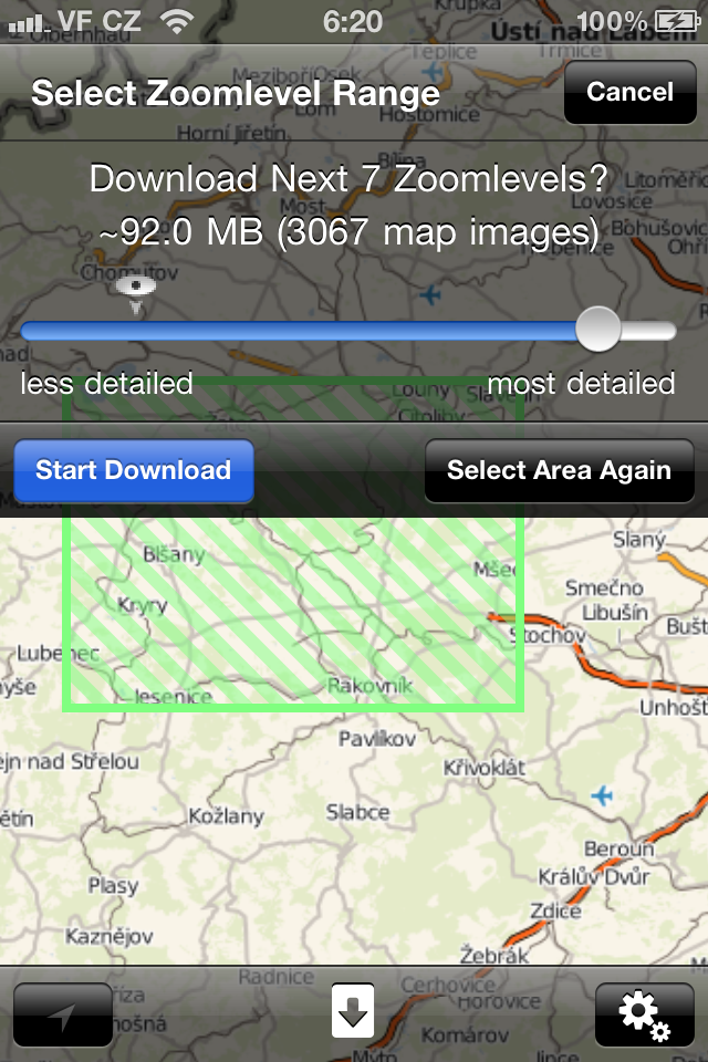
In the second case, you will have to play around a bit. First of all, you need to have a map ready at the given location and a suitable zoom. Then you press the button at the bottom of the bar in the middle and select "Only Download Map". You will find yourself on the map again, where you mark the area you want to download with a rectangle (the more skilled can also use a square) with two fingers. On the bar that appears, you choose how big a zoom you want and if the displayed MB value suits you, you can download the map (Prague at the 2nd largest zoom takes about 100 MB). Of course, this will take a while, so I recommend that you set the display shutdown to "Never" before starting. In addition, cashed segments are automatically saved. So we have downloaded the map and now what to do with it.
Guides - for true offline use
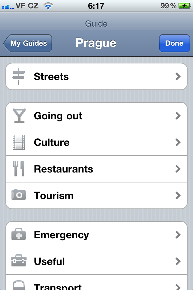
Unfortunately, the map itself will not be enough for you to use it fully offline. If you want to search for streets or other POIs, you still need internet access because the offline map itself is "just an image". The so-called Guides are used for real offline use. Guides include all information about streets, stops, businesses and other POIs. This is probably the biggest stumbling block of the entire application, as the offer of cities with these guides is as limited as with pre-prepared city maps for download, i.e. 10 for CZ and SK (Larger states are of course better off).
As a result, OffMaps probably loses the charm of the nickname Off(line) for many, but luckily, thanks to the already saved map data in the iPhone, a lot of data is not downloaded when searching. So we can talk about a kind of half-offline mode. Another small disappointment is that the guides are not completely free. At the beginning we have 3 free downloads and for the next three we have to pay €0,79 (or $7 for unlimited downloads). The download does not only apply to new guides, but also to updates of downloaded ones (!), which I consider to be quite unfair to users.
You will not be deprived of navigation
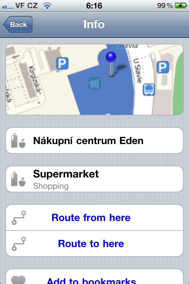
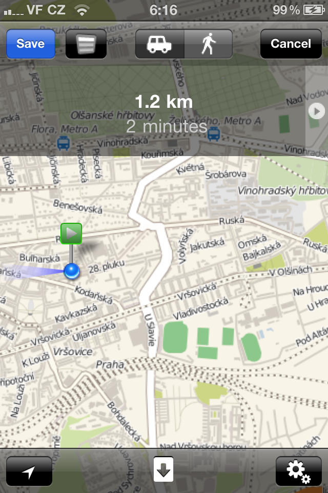
At first I wasn't quite sure if OffMaps could navigate. Finally, it can, but it has this feature well hidden and only available in online mode. Navigation works by first marking two points, i.e. from where and to where. This can be done in several ways. Such a point can be your bookmark, search result, current location or any interactive point (POI, stop, ...) on the map that we mark with a held finger. Here you choose via the blue arrow whether the route will start or end there.
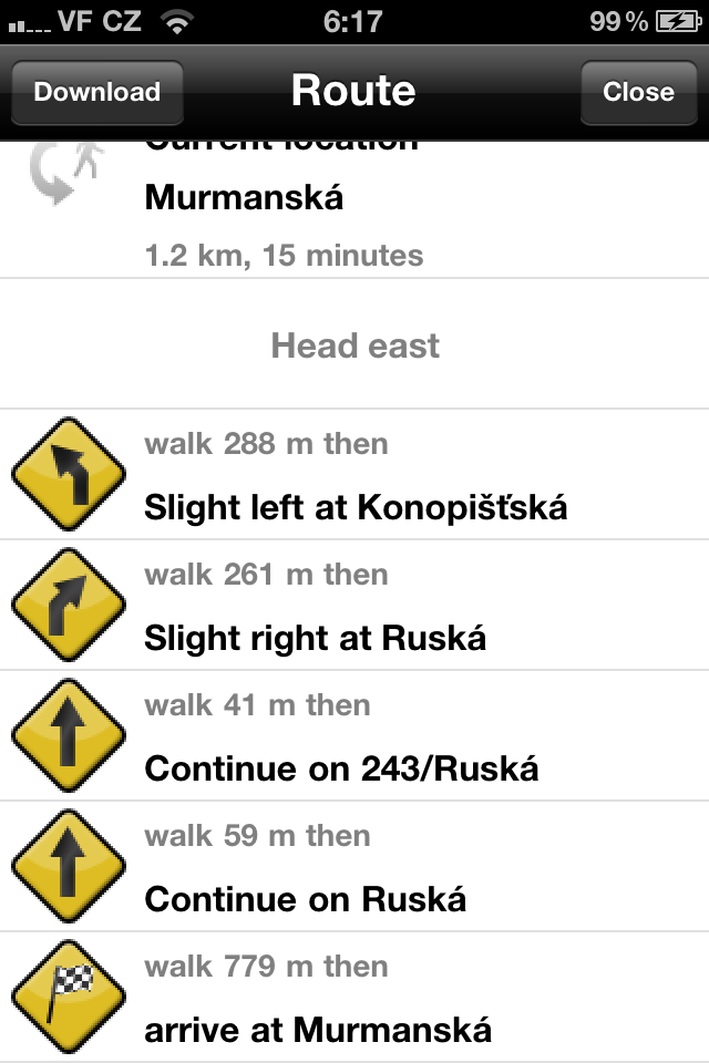
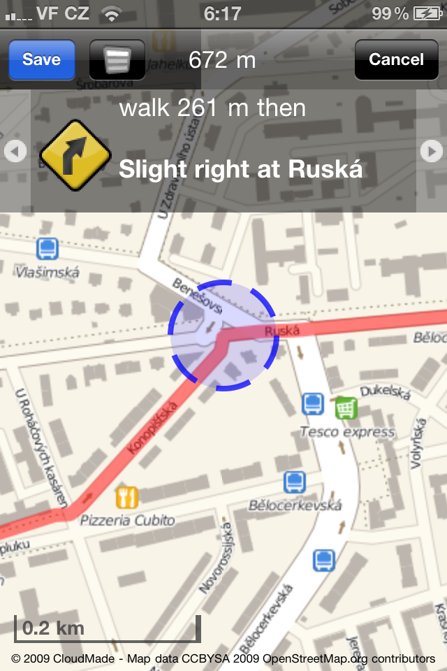
When the route is determined, the application generates its plan. You can choose a route by car or on foot, and then you will be guided gradually where the application should use the integrated GPS (I don't have the opportunity to test it now) or you can go through the route manually. Of course, this is still a 2D map view, don't expect any 3D. You can also save the route or view the route navigation as a list.
In the settings, we can find Cache Management, where we can delete saved caches, and there is also a switch between Offline/Online mode, where not a single kilobyte is downloaded when "Offline" and the application will only refer to the present wizards. We can also change the graphic style of the map plus other HUD matters.
Offmaps is in itself an excellent application for viewing maps offline, the flaw in the beauty is the necessity of guides available only for big cities and their charging. You can find it in the Appstore for a pleasant €1,59.
iTunes link - €1,59
I have. I don't buy apps, but sometimes I buy something here and there. I travel a lot and can highly recommend it. The maps are OK (I've tried Prague, Berlin so far) and even a kind of offline "navigation" works! according to Wifi.
I just follow the map and a blue dot is displayed - it's not very accurate, but it's enough for a rough orientation. I don't find the controls so intuitive anymore, but for the price it's a bomb.
The guides that the author criticizes, I don't mind their option of 2 for free and adding another one for money - I had the opportunity to try them and somehow they didn't grow to my heart - anyway, I'm usually looking for a specific street or something and I don't care to know how many museums and restaurants are nearby etc. In my opinion, they are not necessary (I haven't used them yet and I use these maps quite often).
In short, one can live without these guides (which make my search more confusing) and the maps are surprisingly good for the price. It would probably win the "lots of music for little money" app contest for me
I'm not criticizing the guides themselves, it just bothers me that their update (the purchased ones) is not free.
Why aren't the maps saved as vector graphics? it wouldn't need X zoom levels and it would take up much less space.
I tried them abroad and when the operator was switched on, the GPS still didn't work for me (yes in the guilds), so it doesn't navigate abroad, at least not me :( so I gave up, because it was mainly about abroad, where I don't have data, but now I use Traps Europe and it works great, it's much better and more accurate + even for the car, we had it for free and otherwise it costs similarly little...
I wanted to add that the "offline" navigation works for me via Wifi (well, I have an iPod, so where else would it come from). It's not accurate at all, but it's good for orientation.
I wanted to have, for example, the entire CR in offline mode, on multiple levels, but it was a birth to download. Constantly limited to max 2GB of downloaded data via wifi, in the end I downloaded about 4-5GB and it still wasn't all, so I turned it off. The app is good, for example I find it ideal for downloading the city, plus some things around, but for some larger maps. If the maps were in vector graphics, it would be a different matter.
In any case, if you need to go to Berlin or a larger city and nowhere else, I would recommend them, if you want to cross, for example, half of the United States or Germany, then I would already consider a foreign connection, or directly some kind of navigation.