Google Maps is one of the most popular map and navigation applications ever. They are based on a simple user interface, accurate data and a large worldwide user base, who can add various data themselves and thus refine the entire application as such. Given its popularity and prevalence, it's no surprise that Google is constantly working on its solution. Therefore, let's focus on 5 innovations that have recently arrived or will arrive in Google Maps.
It could be interest you
immersive view
Google was able to gain enormous popularity by introducing a new feature called Immersive View. This function uses advanced artificial intelligence capabilities in combination with Street View and aerial images, according to which it subsequently creates 3D versions of specific places. However, it does not end there. The whole thing is supplemented with a number of important information, which can relate to, for example, the weather, traffic rush or, in general, the occupancy of the given place at a specific time. In addition, something like this has a relatively wide range of applicability. After all, as Google mentions directly, people can make it significantly easier to plan their trips and trips, when they can specifically look ahead to a certain area and, for example, view nearby parking lots, entrances, or check the weather at a specific time or the busyness of nearby restaurants.
Given the scope of this news, it will of course not surprise anyone that it is limited to only a few selected cities. Specifically, it is available to users in Los Angeles, San Francisco, New York, London, and Tokyo. At the same time, Google promised to expand to Amsterdam, Dublin, Florence and Venice. These cities should see it in the next few months. However, the most important question is when the function will be extended further, for example to the Czech Republic. Unfortunately, the answer is not in sight for now, so we have no choice but to wait patiently.
It could be interest you
live view
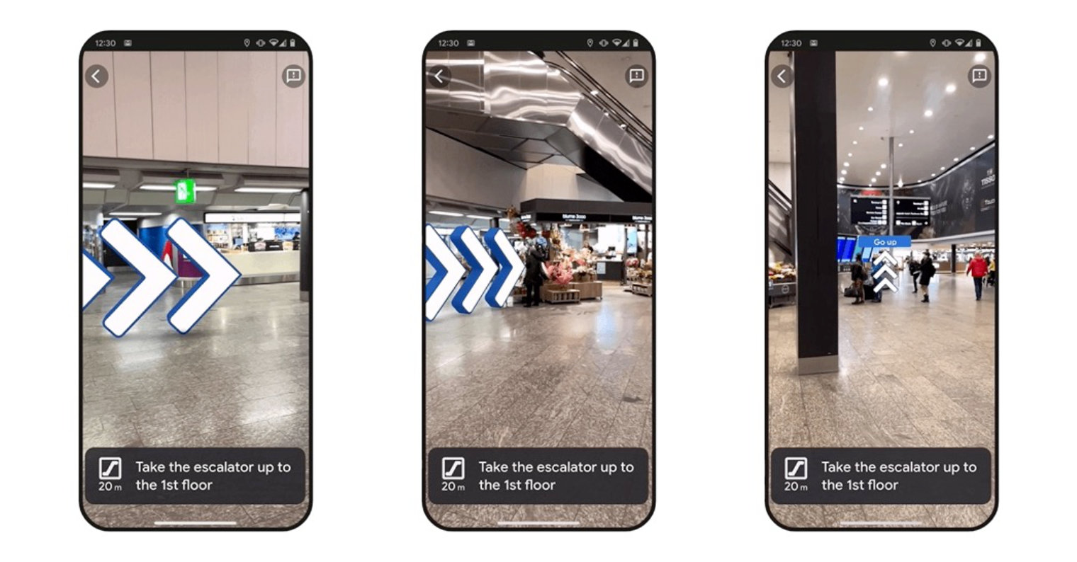
Live View is a quite similar novelty. It specifically uses the possibilities of artificial intelligence in combination with augmented reality, thanks to which it can significantly facilitate navigation in large cities, and thus also in "more complex" and unknown places, such as airports and the like. In this direction, the Google Maps application directly maps the surroundings through the camera lens and can subsequently project arrows showing the direction through augmented reality, or inform about important elements such as ATMs in the vicinity.
However, the Live View function is currently only available in London, Los Angeles, New York, Paris, San Francisco and Tokyo. However, Google mentioned that it plans to soon expand it to more than a thousand airports, train stations and shopping malls in Barcelona, Berlin, Frankfurt, London, Madrid, Melbourne and more.
Reduction of fuel consumption
Google has incorporated a rather nifty element into its Google Maps application that can help you save fuel when using navigation. The chosen route has a major influence on consumption, not only with regard to the distance, but the overall journey as such. The engine type of your vehicle also plays an important role in this, i.e. whether you drive on petrol, diesel, or if you have a hybrid or electric car. Within Google Maps, you can therefore set the engine type of your car and activate v Google Maps > Settings > Navigation > Prioritize economical routes. In this case, the maps automatically prioritize routes with lower fuel consumption.

Electromobility
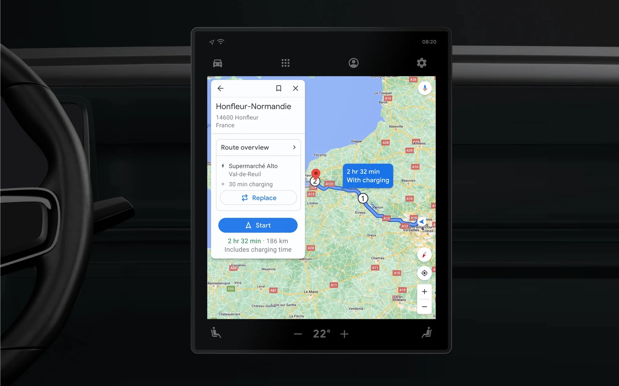
Electromobility is currently on the rise and is enjoying increasing popularity. At the same time, newer and significantly more efficient models are coming to the market, which can faithfully convince potential buyers and accept them into the world of electromobility. Of course, Google also responds to this with its map and navigation software. In February 2023, therefore, a series of novelties intended for drivers with an electric car headed into the solution.
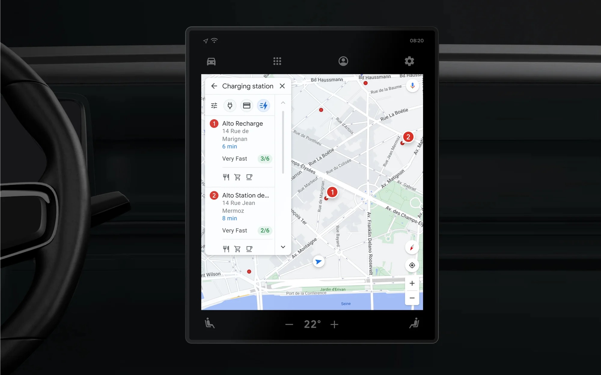
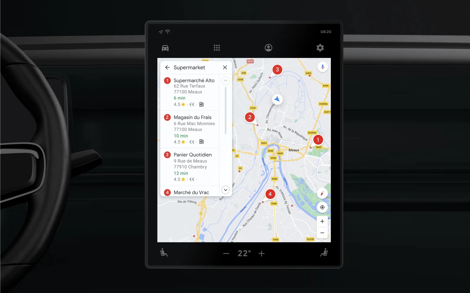
When planning a route, Google Maps can automatically make stops for you to charge your vehicle, choosing the ideal charging station based on several factors. It mainly takes into account the current state, the traffic situation and the expected consumption. So there is no need to worry about where and when you will make a stop. In the same way, charging stations are starting to appear directly in the search, where you can also use filters to set the application to show you only chargers with fast charging. These options are available for all electric cars with the built-in Google app.
Glanceable Directions
Google also recently introduced another rather interesting new feature called Glanceable Directions. Although Google Maps ranks among the most popular applications of its kind, it also has certain shortcomings. If you only want to visualize the route from point A to point B, then it is quite difficult to follow it. In many ways, this leaves you with no choice but to switch to navigation mode, but this can be a hindrance in some cases. Glanceable Directions is the solution to this deficiency.
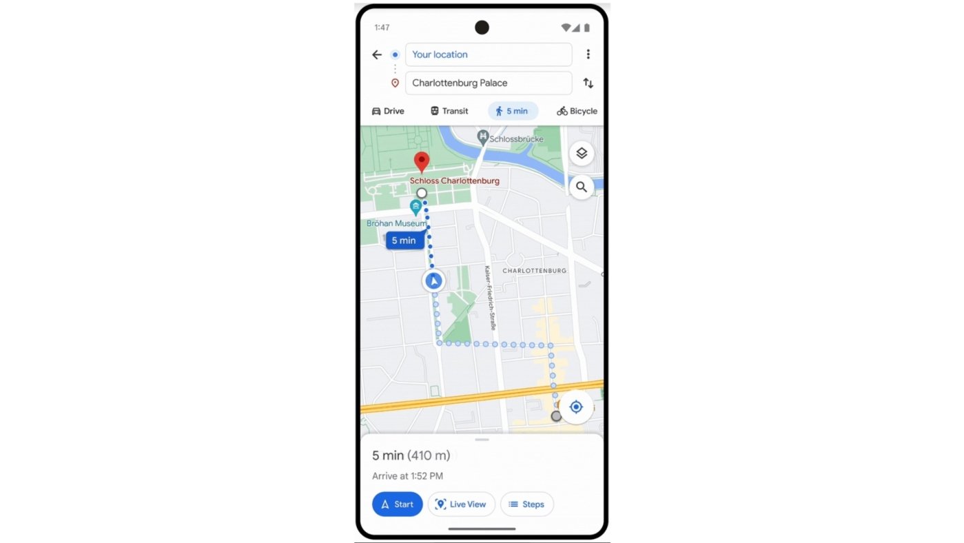
Soon, a long-awaited new feature will arrive in Google Maps, thanks to which the solution will navigate you even from the screen showing the route. To make matters worse, navigation will also be available from the locked screen. In some cases, it may not be the safest to unlock the device to view the route, especially while driving. In iOS (16.1 or later), the app will therefore inform you via Live activities about ETA and upcoming detours.
 Adam Kos